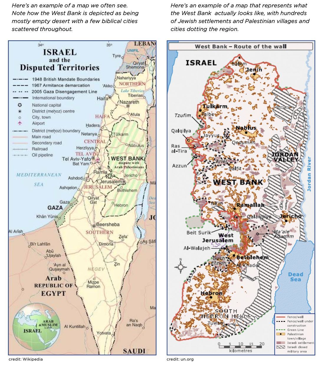
Dear Friend, You should be receiving a letter from me in your mailbox soon about maps. Remember maps? Paper maps may be a bit of a vestige of our pre-iphone times, but they are still widely used in classrooms, Congressional and other public offices, even synagogues. Maps are a political tool. They tell stories – about land, about space. About Occupation. If you look at the standard map of Israel today, the one that is in classrooms across Israel, as well as in our own institutions in the US — day schools, synagogues, youth groups, camps — and Congressional offices, you’ll notice that in all likelihood, that map is missing a critical piece of information. The Green Line delineating between Israel and the Occupied Territories does not appear. And beyond that Green Line, the West Bank is shown as an empty space, having been stripped of both the Israeli settlements and Palestinian cities, villages and towns that house the over 3 million people who live there. With our partners at Shalom Achshav, APN is working to correct this misinformation and create a map that tells the true story of what the land looks like on the other side of the Green Line.
But we need your support to make this happen. | |
This is what APN does best – we speak, and show the truth and are a trusted resource to policy makers and community leaders across the country. When an accurate map is hanging on the wall, it is much harder to ignore the brutal facts of Occupation. | |
So read about our map project in this letter and then help us with a donation to print and distribute maps that will show what life really looks like on the other side of the Green Line. | |
Hadar Susskind President and CEO, Americans for Peace Now | |